The file is hosted externally (pavelflek-my.sharepoint.com). The button opens the hosting page, where you start the download.
Description
Author: orl_cz/Simulators Czech
Version: 1.0 October 2026
Coverage: all Balearic Islands – Mallorca, Menorca, Ibiza, Formentera, Cabrera, Dragonera and the surrounding islets – DSF tiles +40+003, +40+004, +39+001, +39+002, +39+003, +39+004 and +38+001
Simulator: X-Plane 12
Licence: freeware (non-commercial use only – see Data sources)
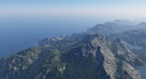
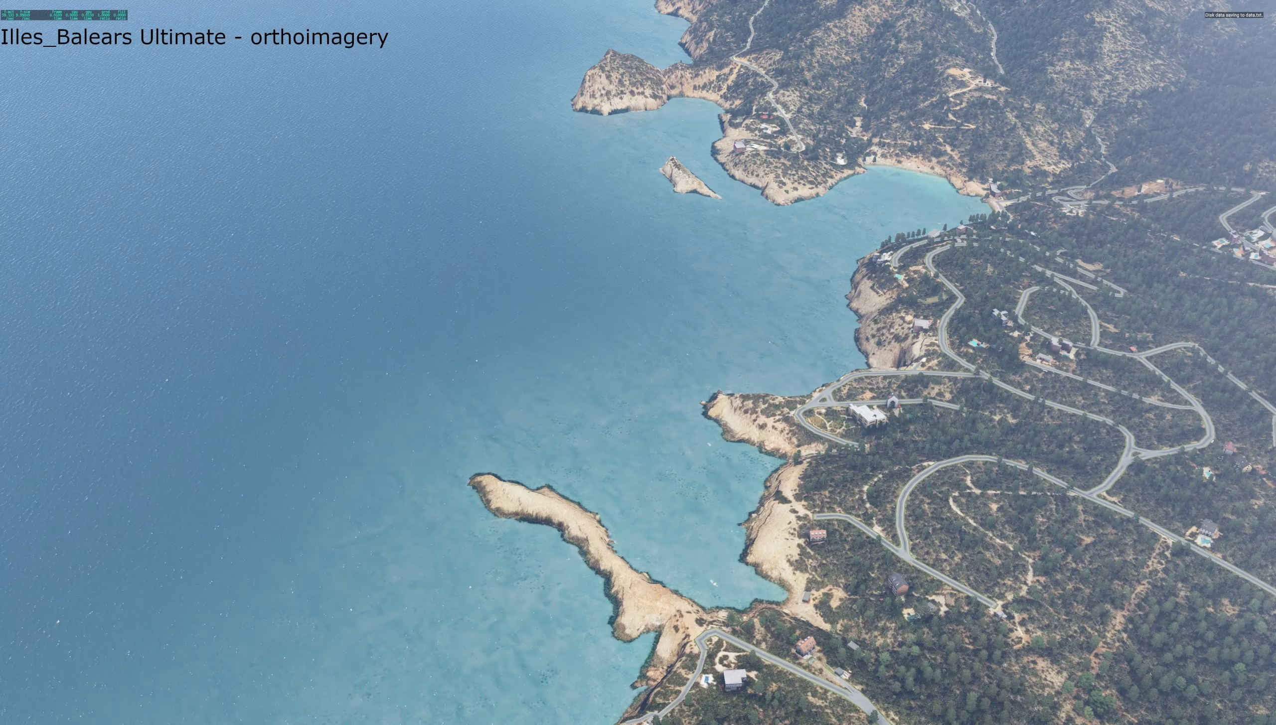
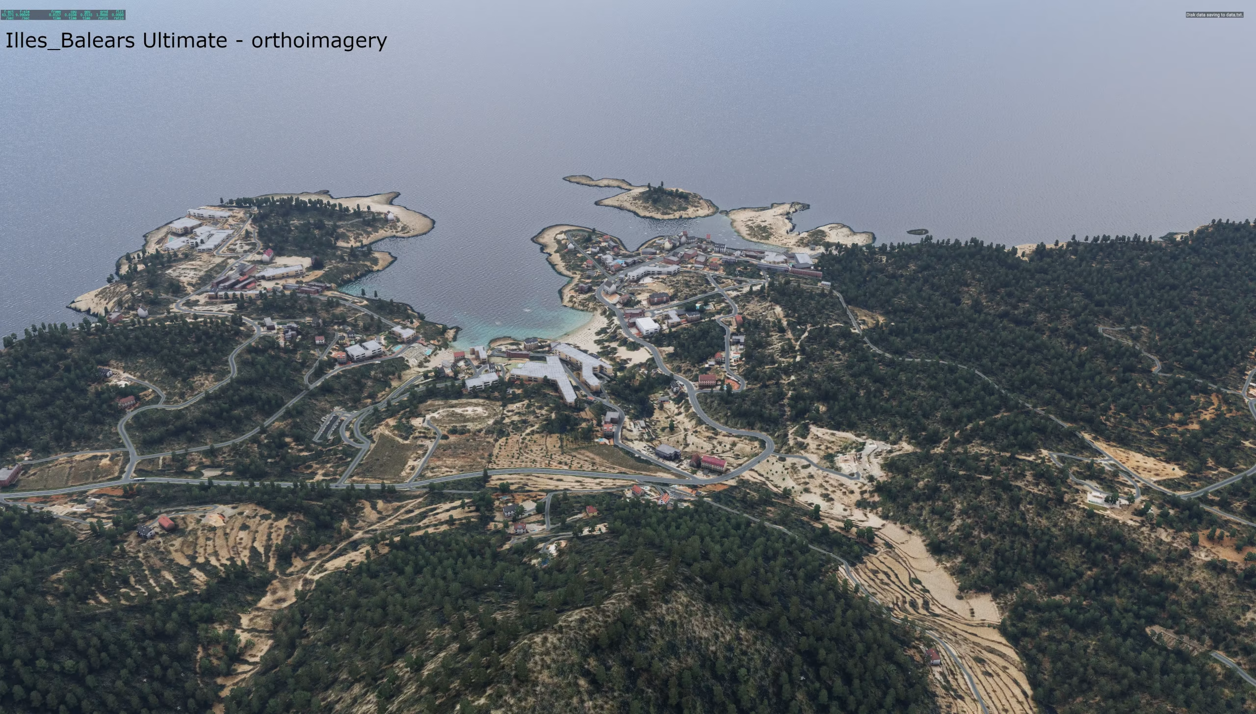
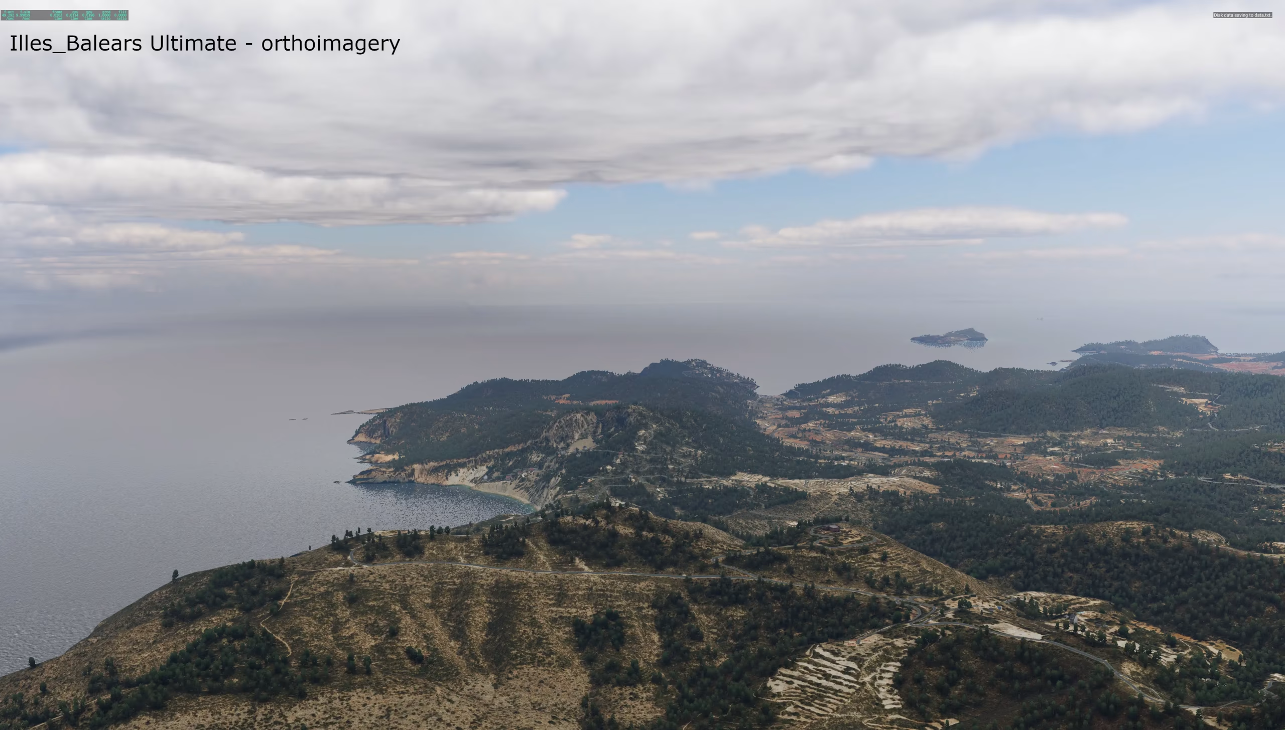
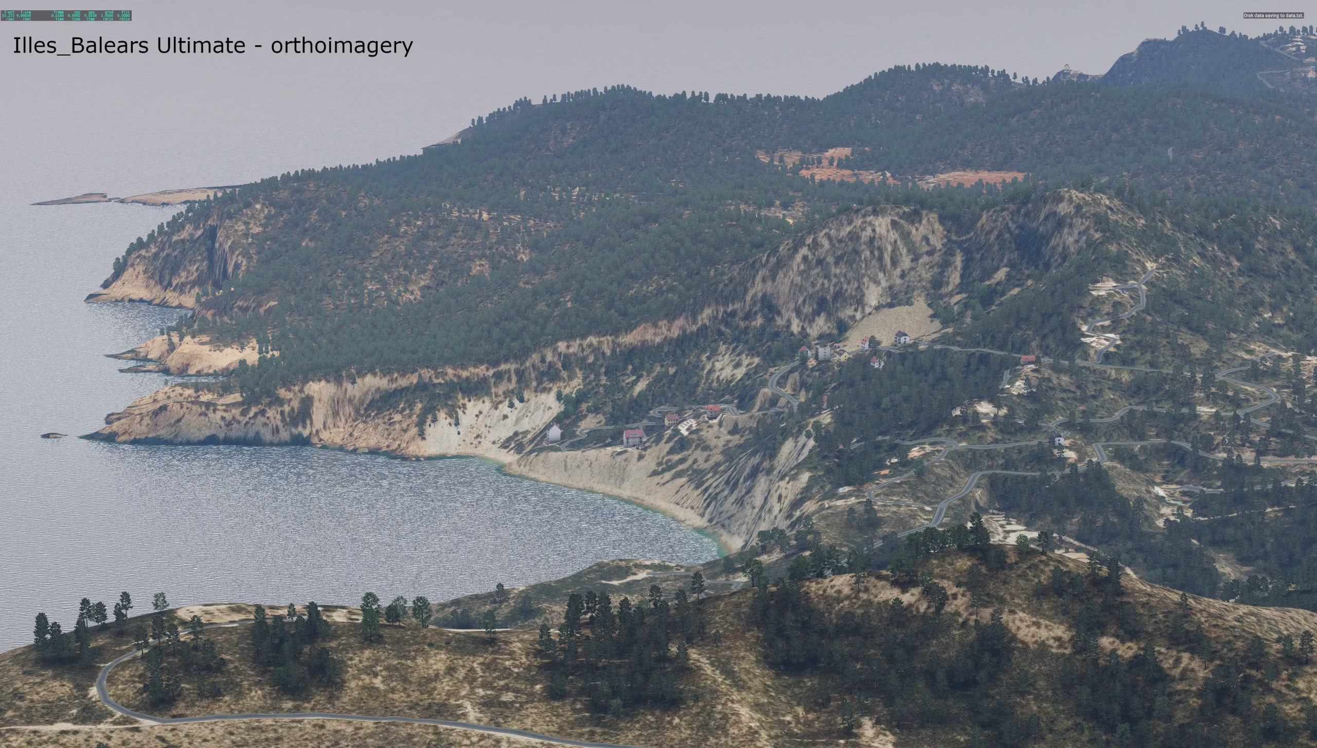
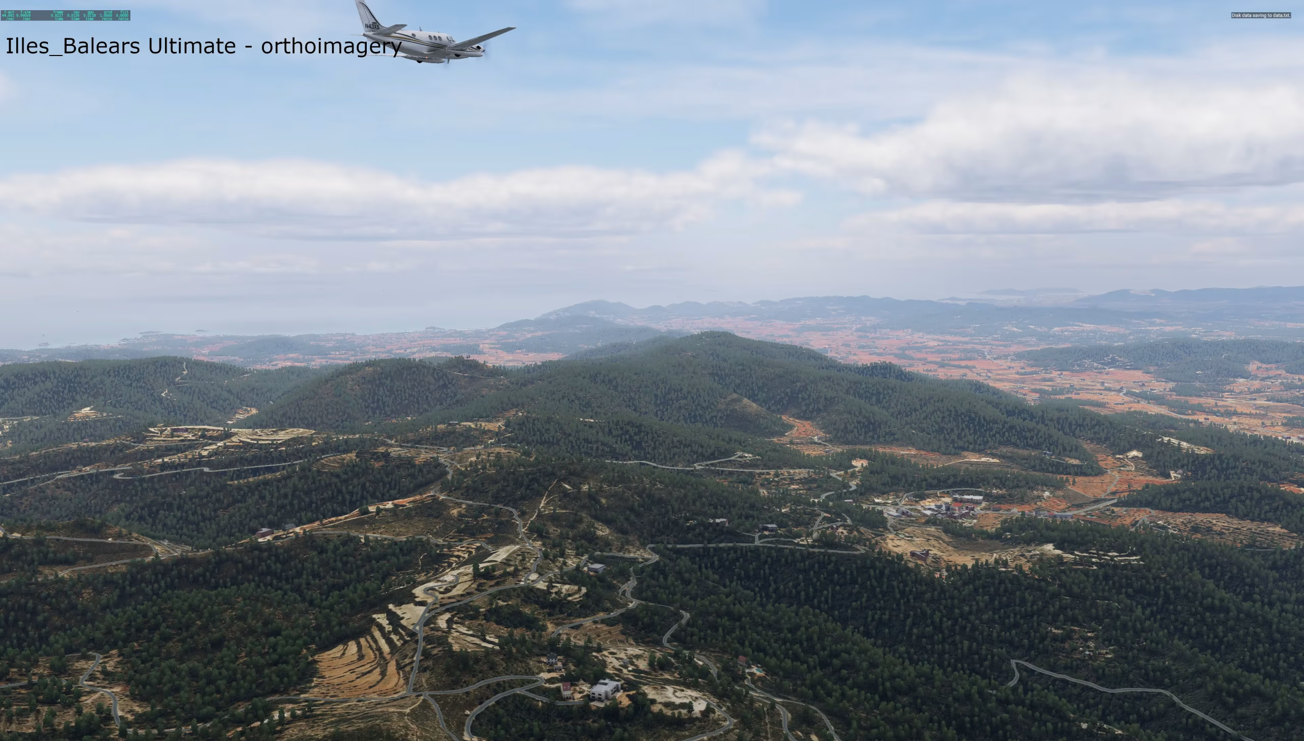
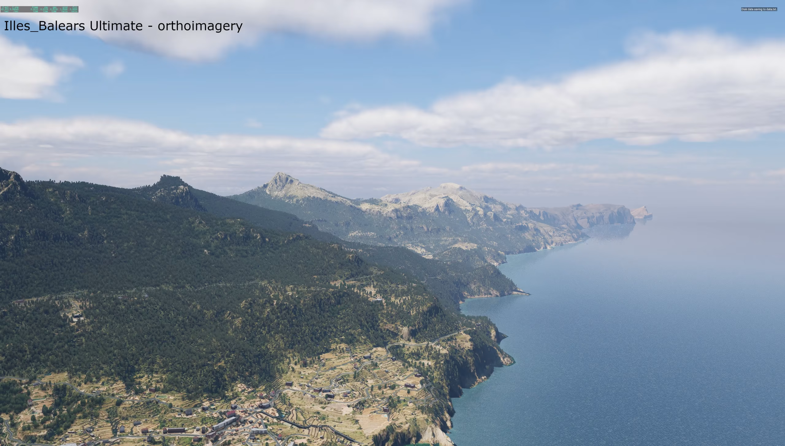
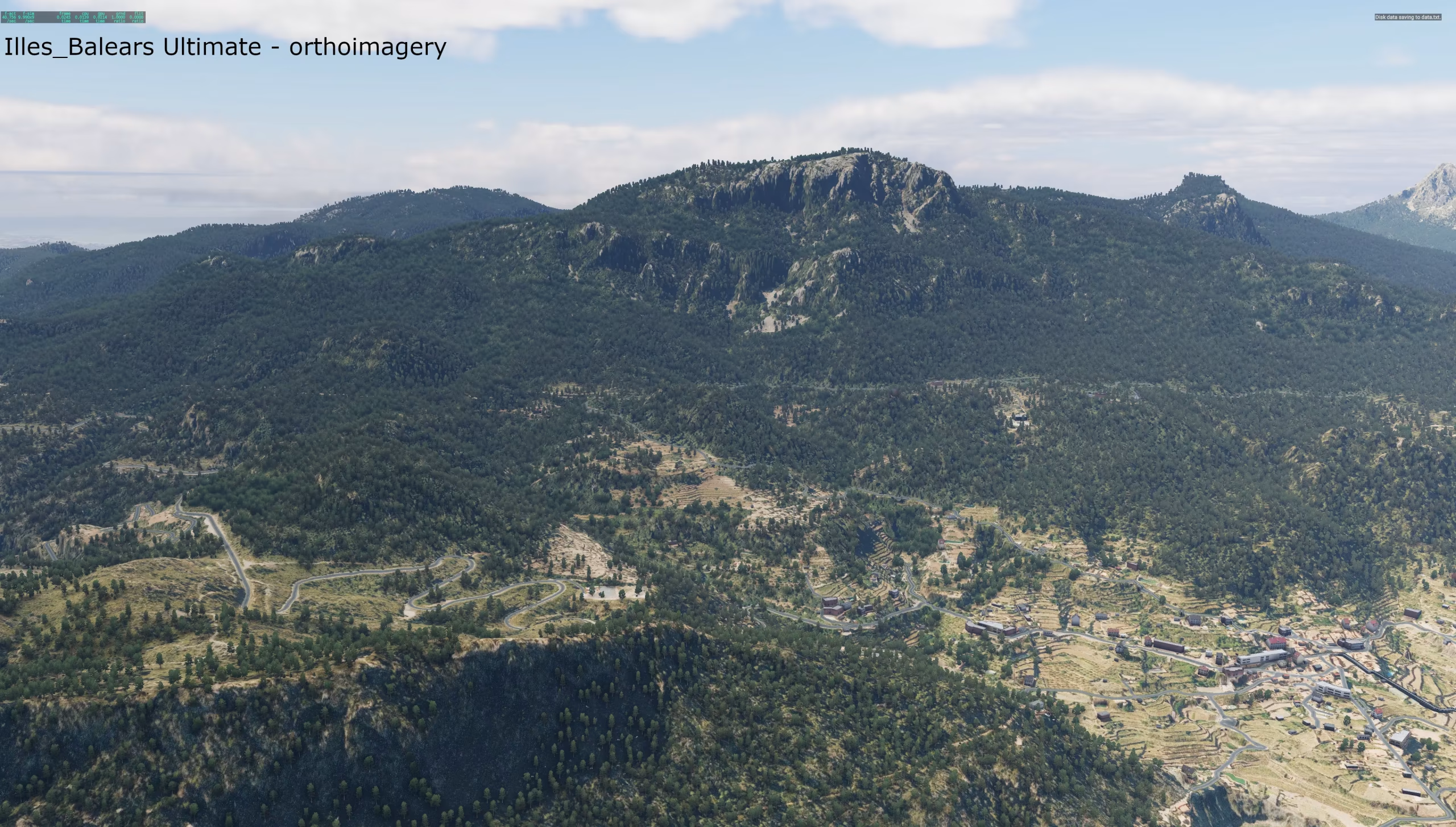
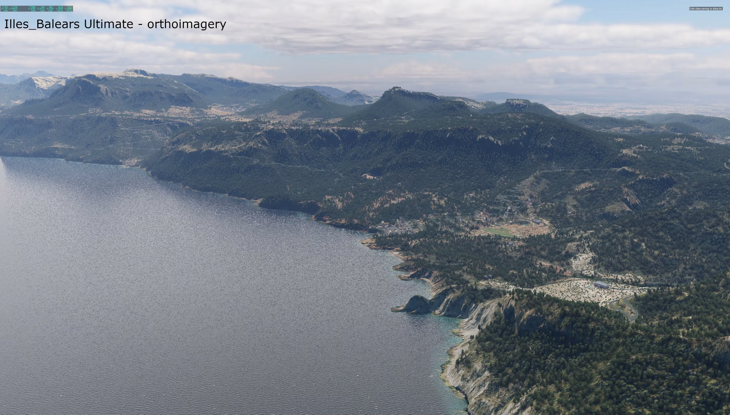
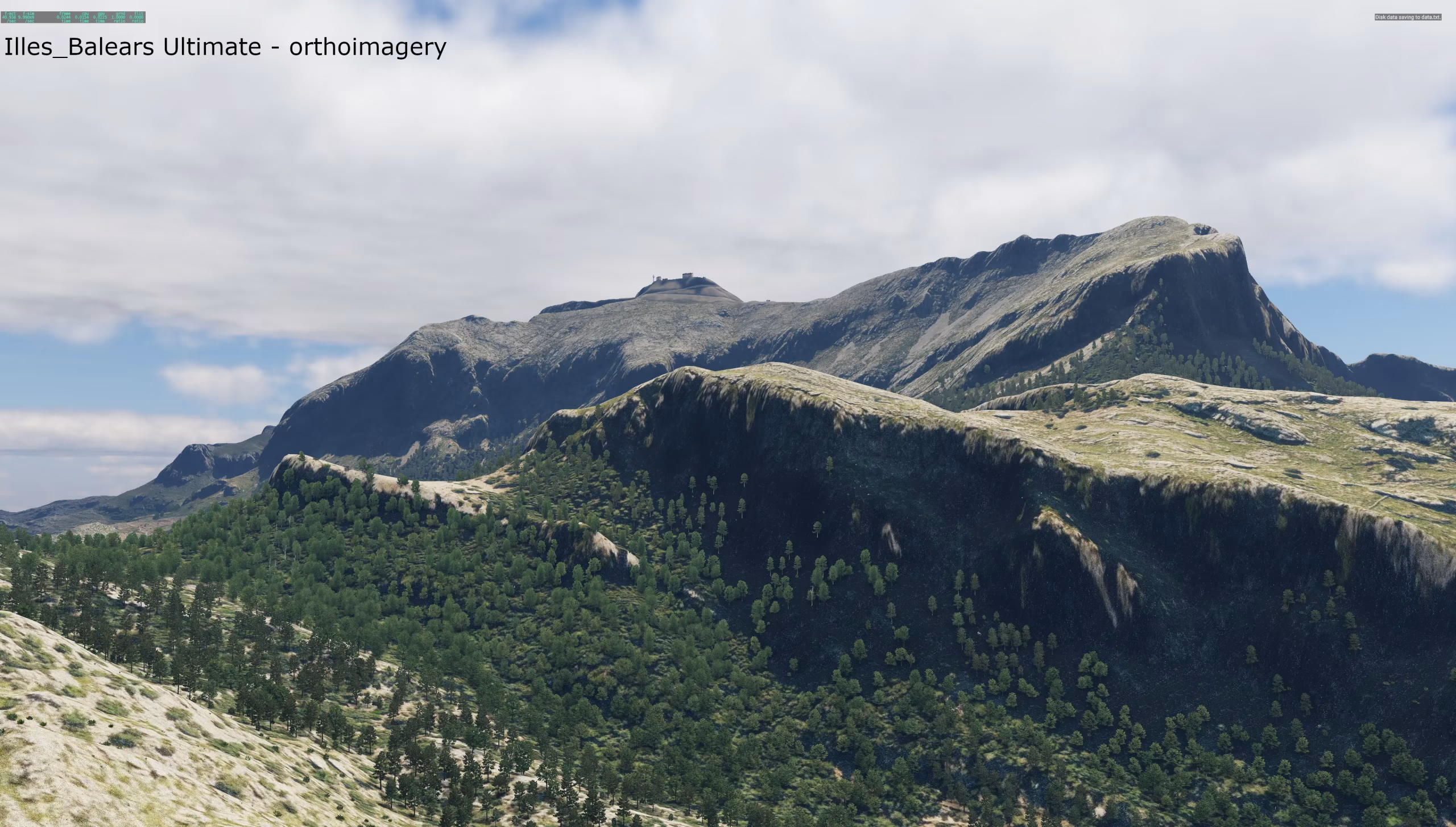
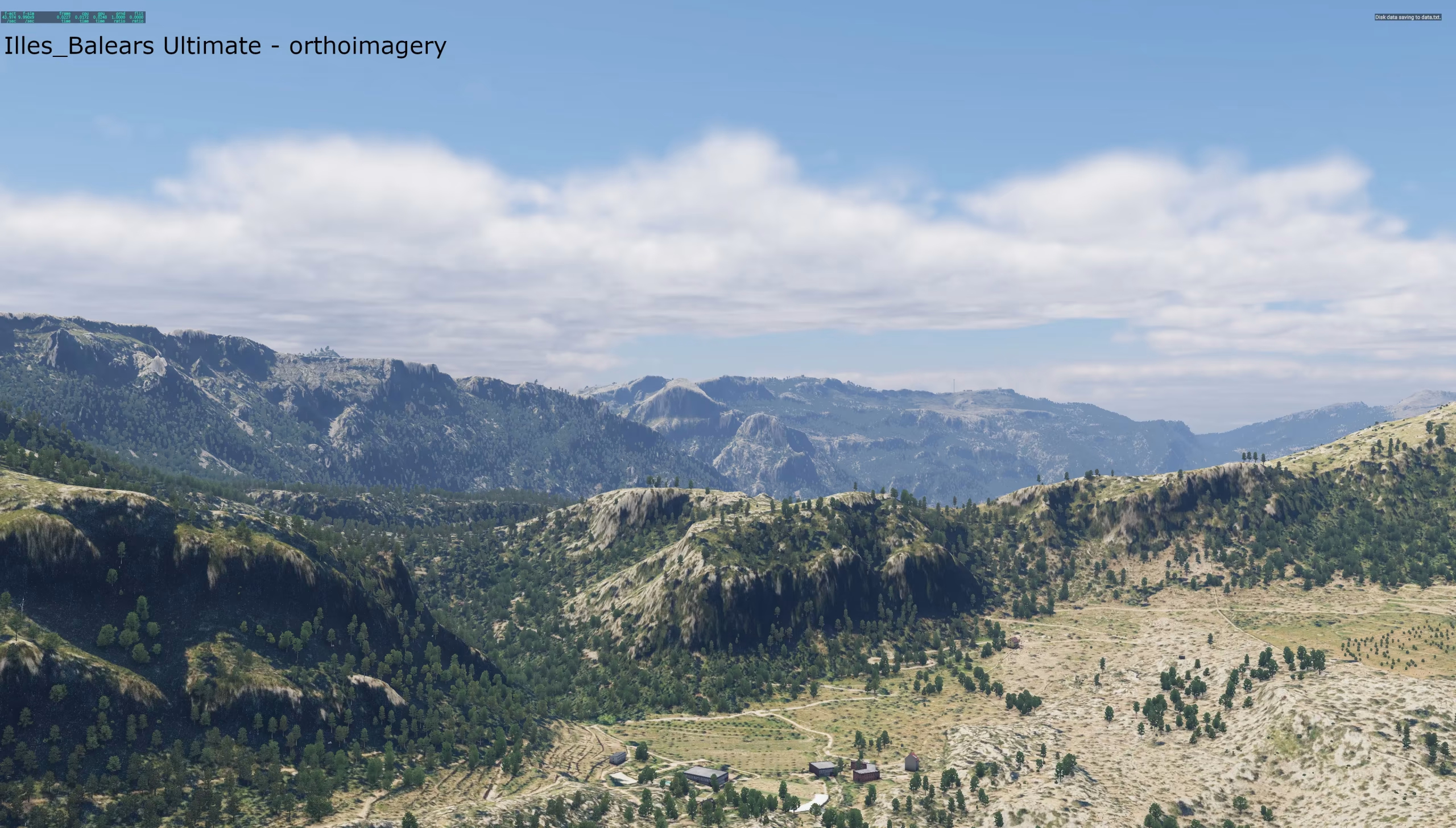
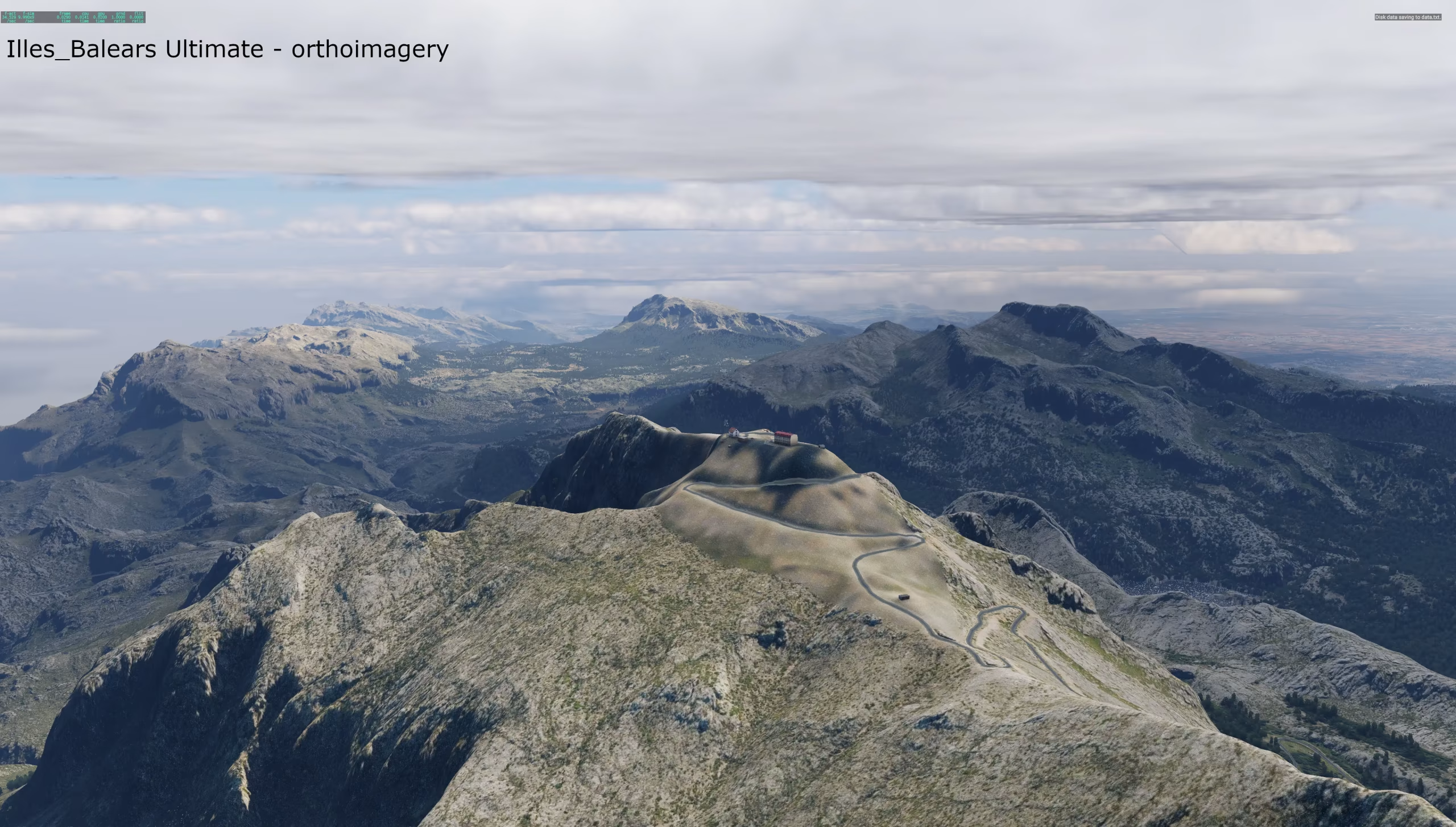
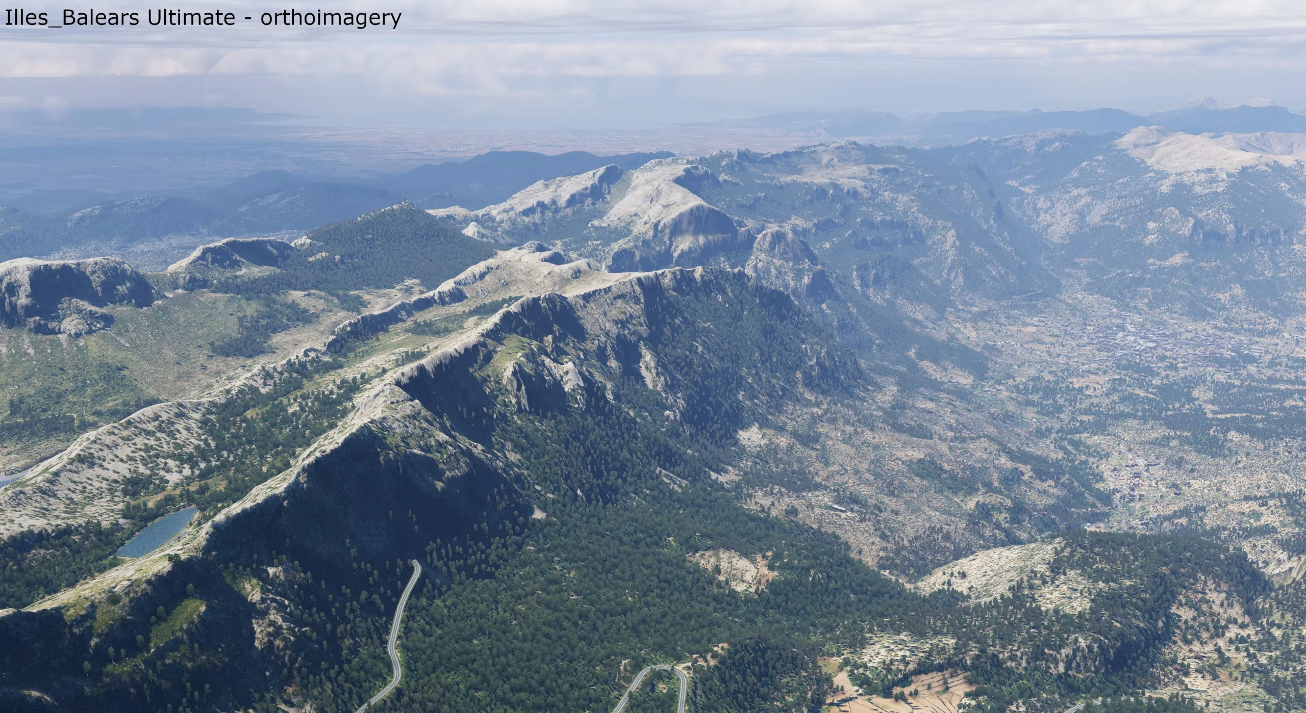
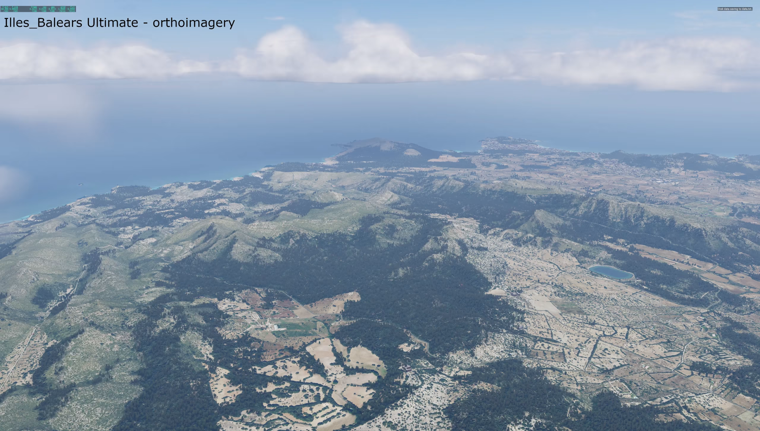
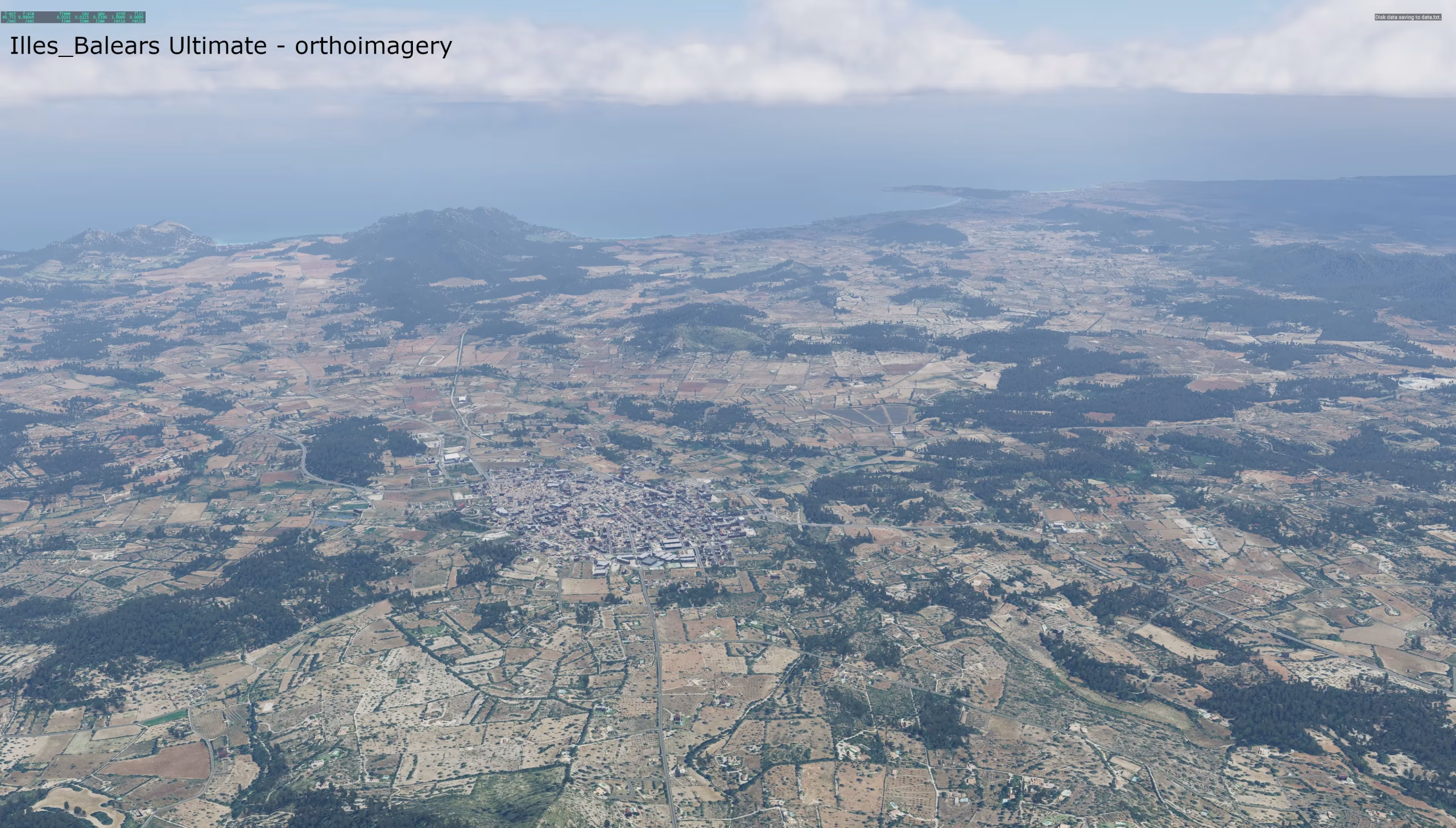
A completely new scenery of the Balearic Islands that replaces the default Laminar Research scenery. It is built from scratch from Spanish government data: the IGN 5 m lidar terrain model, detailed seabed models of the Spanish Hydrographic Institute, European Copernicus satellite vegetation maps and PNOA aerial imagery. The islands are modelled from the peaks of the Serra de Tramuntana down to the seabed off the coast.
The scenery comes in two versions:
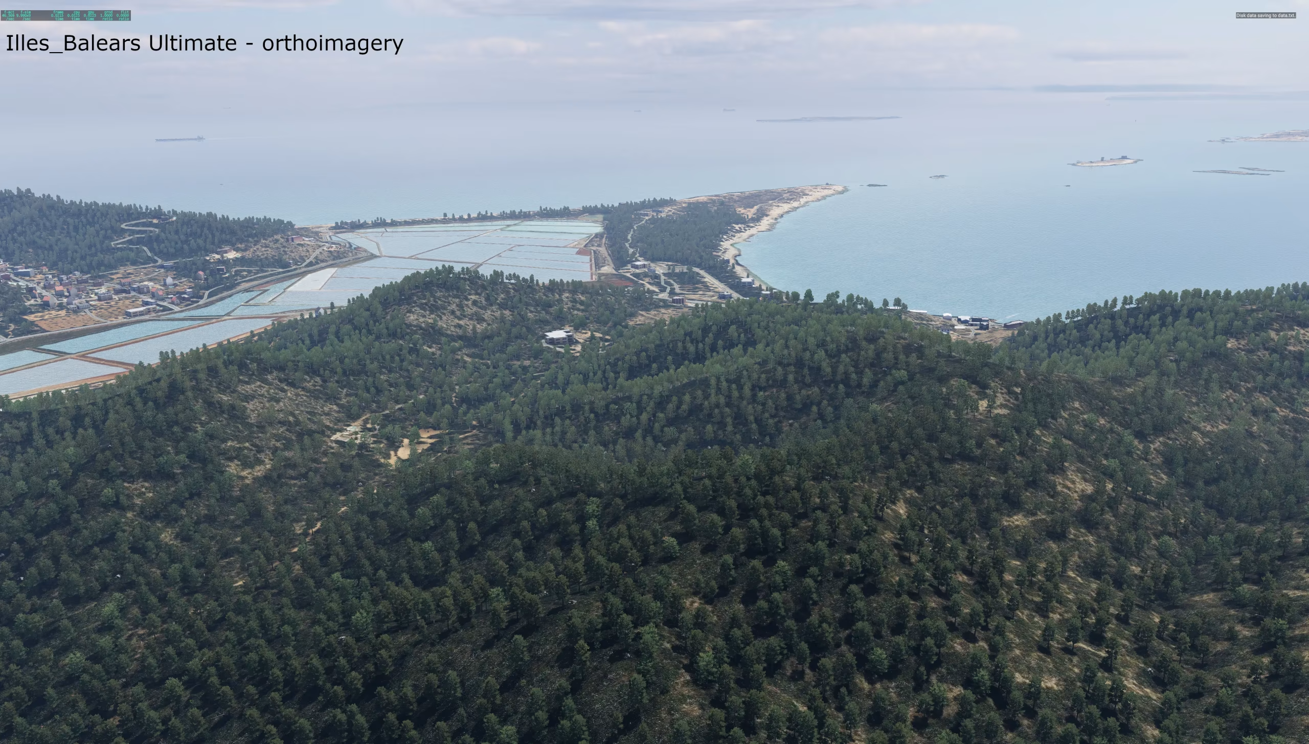
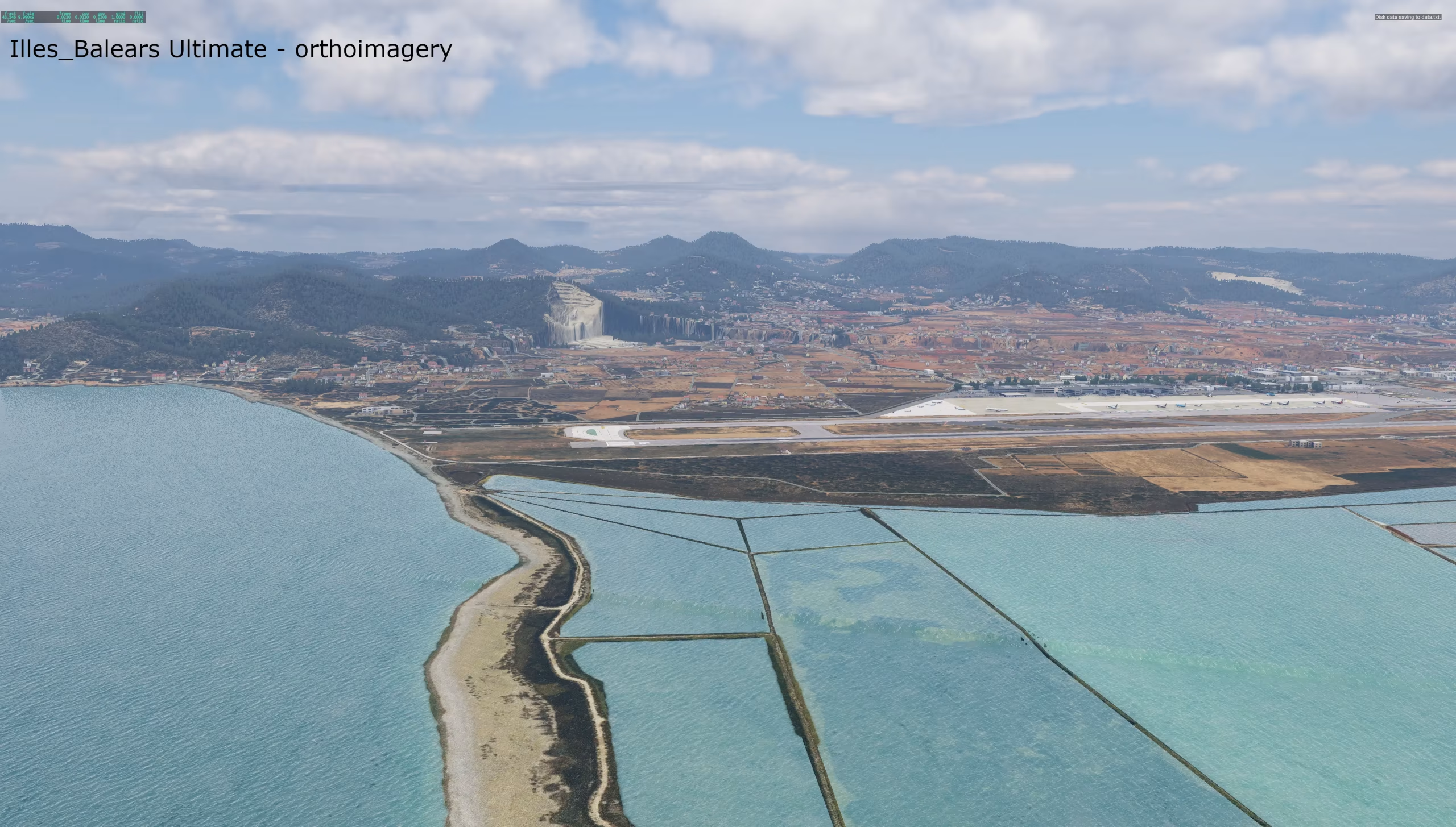
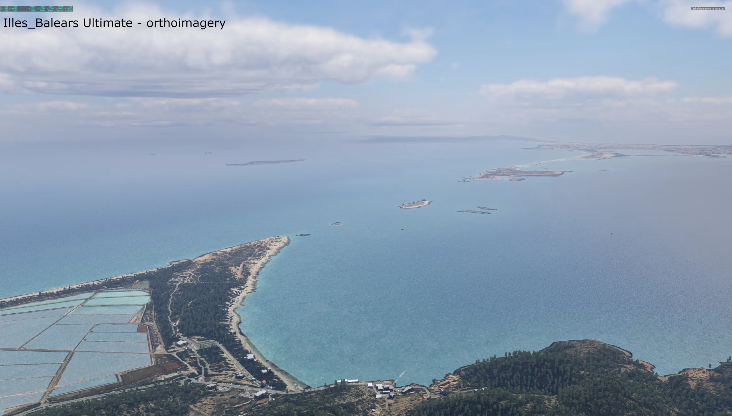
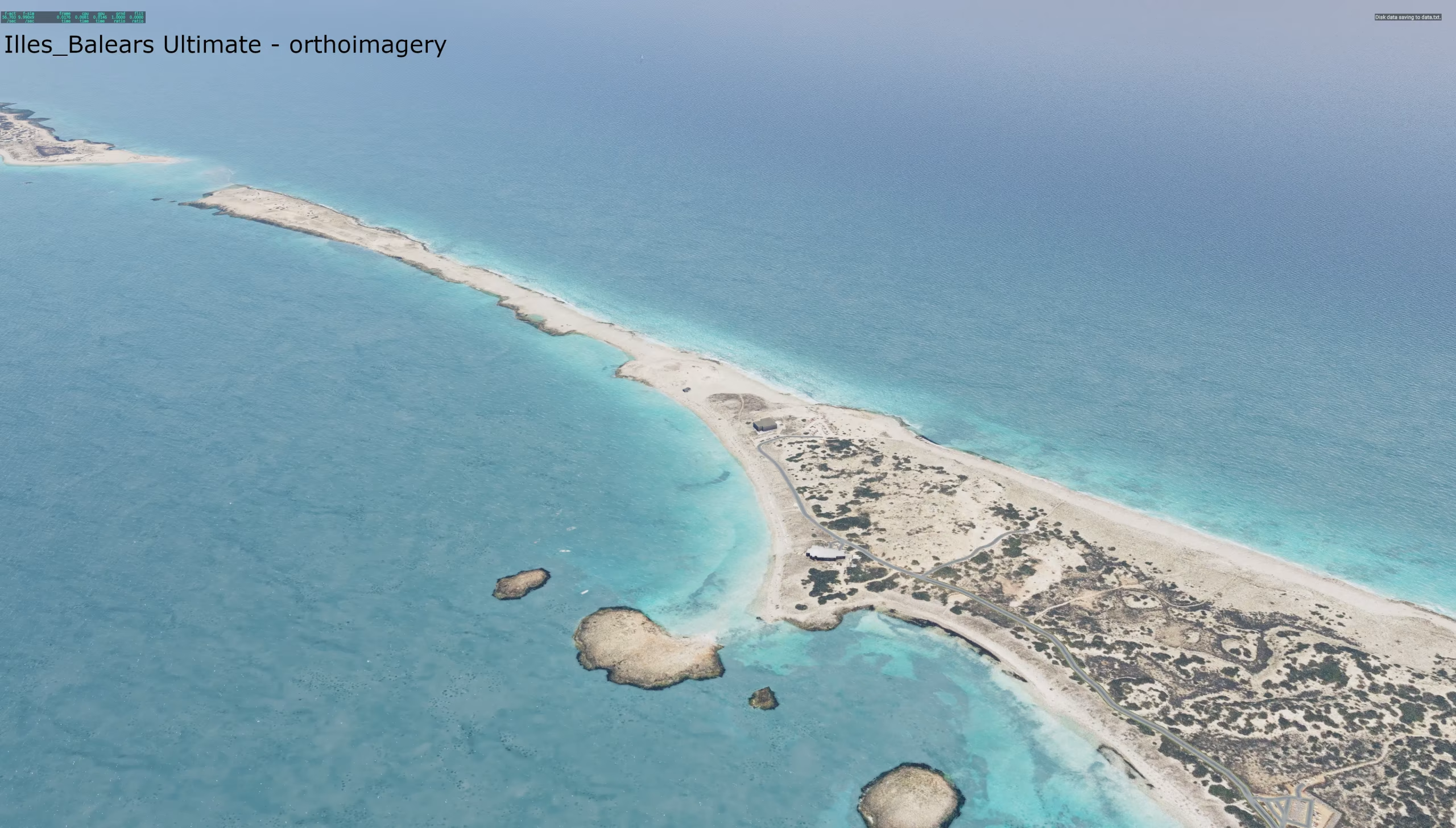
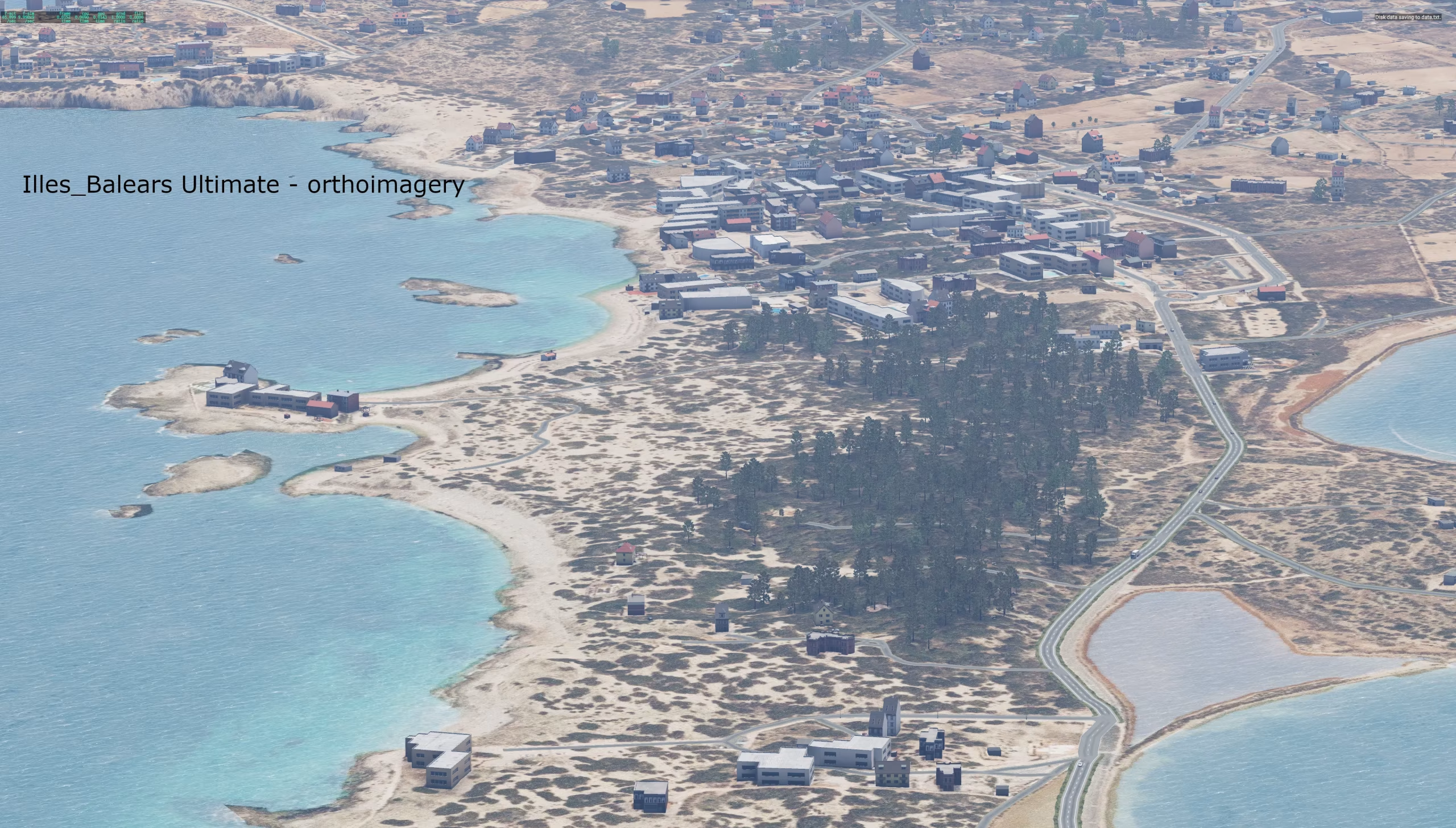
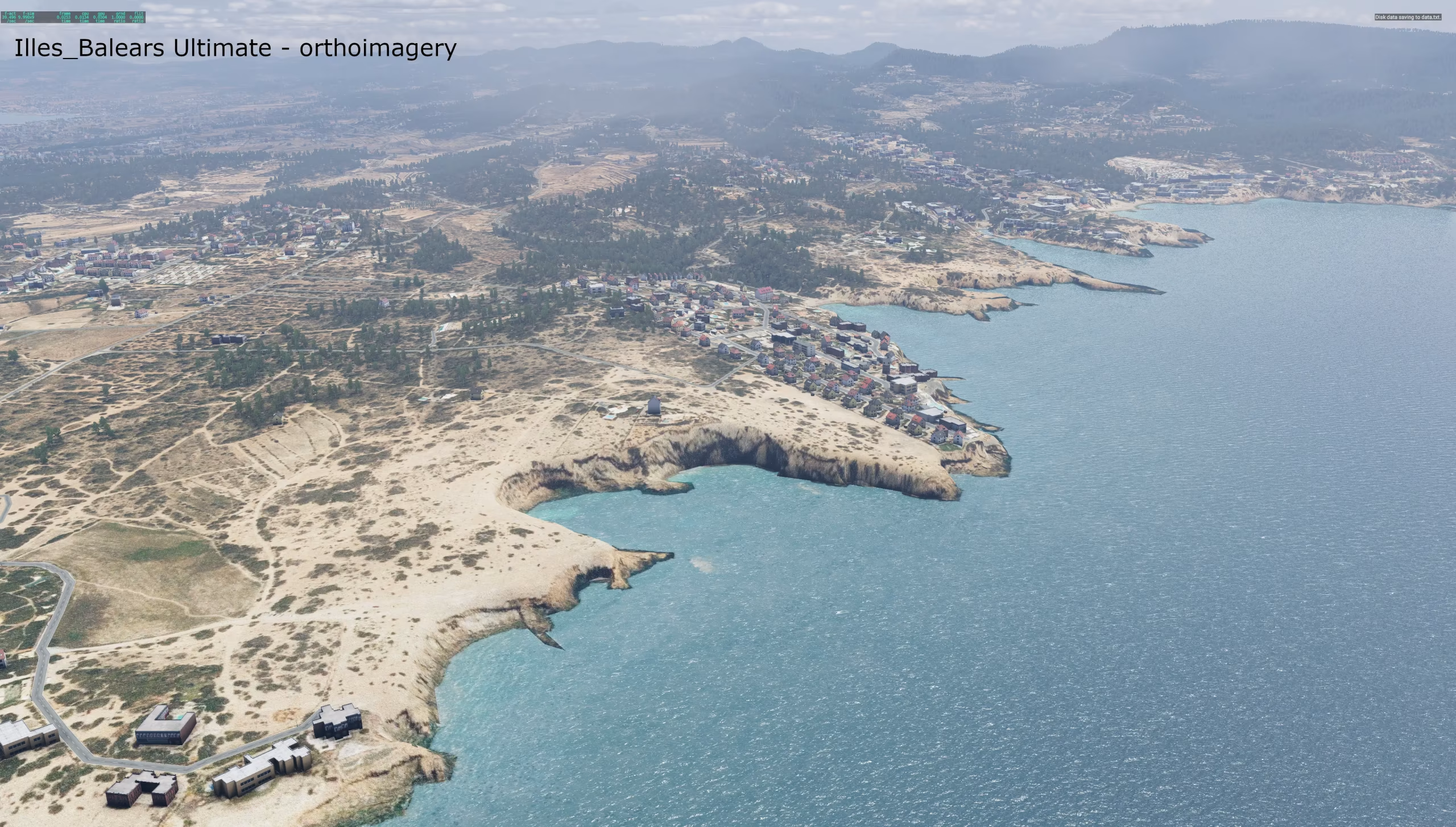
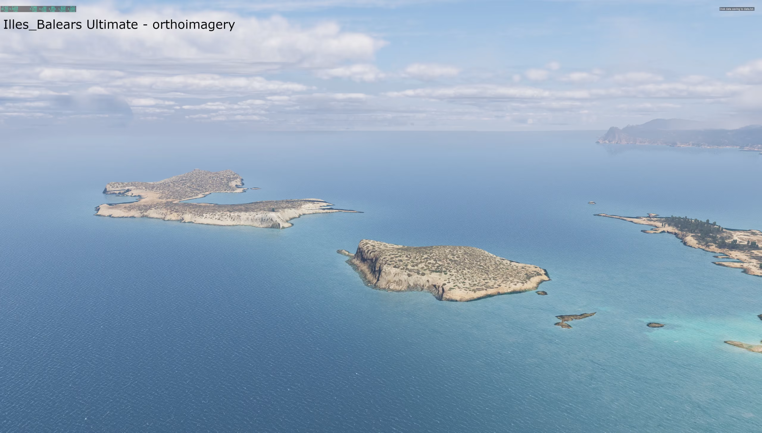
- with aerial imagery (ortho) – a photorealistic surface of all islands from PNOA aerial photos,
- classic – surface from X-Plane textures according to the real land cover, for less powerful computers.
Autogen is not the priority of this scenery – the main focus is the terrain (mesh). All objects come exclusively from the default X-Plane library (Laminar Research); only the orthophoto textures are custom.
For richer autogen you can use X-World or similar add-ons.
What the scenery contains
Lidar terrain – 5 m instead of 90 m
- MDT05 terrain model of the Balearic Islands (IGN / CNIG) – derived from PNOA airborne laser scanning, with a vertical accuracy of about ±0.4 m. It covers 100 % of the land of all islands (4,939 km²); no area had to be filled with global data.
- The whole 5 m elevation model directly in the DSF: the Mallorca tiles carry an elevation grid of 17,180 × 22,265 points (5 m spacing). The default X-Plane 12 scenery has a grid of 1,201 × 1,201 points (90 m spacing) on the same tile – roughly 265× fewer elevation points. HD Mesh and Ortho4XP use global 30–90 m data by default.
- Points where they are needed: 5 m is the density of the source data, not a regular triangle grid. The mesh places points densely on ridges, cliffs, gorges and the coast and sparsely on flat land – with a target accuracy of 20 cm against the lidar, 5 cm on the coast.
- The ridges and cliffs of the Serra de Tramuntana, the Torrent de Pareis gorge, the cliffs of Formentor and Cap de Barbaria and the Ses Salines salt pans look as they do in reality.
- Heights converted from the island height systems (Mallorca, Menorca, Ibiza) to the global EGM2008 geoid with the official IGN EGM08-REDNAP grid, so they match X-Plane airports and navigation.
Seabed
- 5 m bathymetry combined from five layers (coarsest to finest):
- GEBCO 2026 – deep sea,
- EMODnet DTM 2024 – European seabed model (~115 m),
- IHM MBAR24 100 m – seabed model of the Spanish Hydrographic Institute further offshore,
- EMODnet HR-DTM – detailed local sonar surveys (~2–58 m) off Ibiza, Formentera and eastern Mallorca,
- IHM MBAR24 16 m – detailed model of coastal waters and harbour approaches.
- Erroneous soundings in the source data (hundreds of small pits, e.g. off Formentera) were removed; real seabed features such as the pockmarks off Ibiza and steep slopes were kept.
- Native X-Plane 12 water with colour and transparency according to the real depth – turquoise coves and shallows off Formentera, dark deep sea between the islands.
- Custom water turbidity mask for all seven tiles.
Coast
- Accurate coastline from OpenStreetMap, checked against the terrain (no islet or rock is missing).
- Beaches according to real OSM beaches, not blanket sand around the whole islands.
- Harbours, salt pans and lagoons (S'Albufera, Ses Salines) levelled to the water surface.
Vegetation from satellite data
- Land cover from Copernicus High Resolution Layers 2024: tree cover density, forest type, grassland, herbaceous vegetation and crop types.
- Crops according to real fields – cereals, vegetables, vineyards and orchards.
- Where Copernicus has no data, ESA WorldCover 10 m fills in; forest types refined with the global Copernicus map.
- Plant selection according to the CHELSA climate with an elevation correction – Mediterranean vegetation on the coast, different in the Tramuntana mountains.
- Seasons according to the default X-Plane 12 scenery.
Towns and buildings
- Over 313,000 buildings from OpenStreetMap (OSM in the Balearics also contains imports from the Spanish cadastre), placed on their real footprints; facades chosen according to the climate.
- Building density from ESA WorldCover for a realistic distribution of towns, resorts and villages.
- Industrial zones, cemeteries, quarries, sports grounds, golf courses and parks from OSM.
Roads, networks, obstacles
- Complete road network from OSM.
- Major roads burned into the terrain so that they neither float above slopes nor cut into them.
- Power lines, towers, chimneys, masts and other obstacles from OSM.
Airports
- LEPA Palma de Mallorca, LEMH Menorca, LEIB Ibiza, LESB Son Bonet and other smaller airfields, seaplane bases and heliports (15 in total) from the X-Plane Gateway.
- Terrain under the airports smoothed; paved areas and airport buildings matched to the scenery.
Aerial imagery (ortho version)
- PNOA aerial imagery (IGN / CNIG) under the open CC BY 4.0 licence – no commercial satellite imagery, the package is freely redistributable.
- ZL17 resolution (≈ 0.9 m per pixel) – 3,947 image tiles covering all islands and a 10 km sea band around the coast; at sea outside the PNOA coverage Sentinel-2 cloudless (EOX) fills in.
- Colour-matched (brightness, contrast, saturation) for a natural look.
- Photo on the seabed – in shallows down to 30 m the real seabed from the image is visible under the water.
- The coastal band blends into the beaches, so there are no sharp edges between the photo and the water.
- On the open sea, native X-Plane 12 water remains.
Sounds
- Custom soundscape map – forest, countryside, town, industry and sea according to the real land cover.
Installation
Version with aerial imagery
- Unpack into X-Plane 12/Custom Scenery/:
- ZZ_Illes_Balears_ortho – the scenery,
- Library_Illes_Balears_z14_ZL17 – aerial imagery (required for this version, about 11 GB).
- Both packages must be enabled in Custom Scenery/scenery_packs.ini. Their mutual order does not matter – the imagery package contains only a texture library, no DSF.
Your own orthophoto – imagery replacement tool
The imagery is in a separate package and the scenery loads it by position in a fixed grid (Web-Mercator ZL14; the file name depends only on the position). The package can therefore be replaced at any time – for example with newer PNOA imagery or sharper ZL18 – without changing the scenery. You can create such a package with Orthoscenerytool – Simulators Czech, the tool this one was made with. Place your own imagery package above Library_Illes_Balears_z14_ZL17 in scenery_packs.ini (or replace it); cells your package does not contain are still taken from the original.
Classic version
Unpack the ZZ_Illes_Balears package into X-Plane 12/Custom Scenery/.
Always use only one of the versions – both cover the same tiles. Also disable other sceneries with their own terrain for the Balearics (e.g. Ortho4XP packages) – X-Plane uses the terrain of only one package per tile.
For both versions
- The scenery packages belong in scenery_packs.ini below the airports (Custom Scenery airports and Global Airports) and above the global scenery.
- Water mask: copy +38+001.png, +39+001.png, +39+002.png, +39+003.png and +39+004.png to X-Plane 12/Resources/bitmaps/world/water/+30+000/ and +40+003.png and +40+004.png to X-Plane 12/Resources/bitmaps/world/water/+40+000/. Back up the original files first – an X-Plane update may overwrite them, and then you just copy them again.
Data sources and licences
The scenery is freeware. Because of the IHM MBAR24 bathymetry licence (CC BY-NC 4.0) it must not be used commercially. Data used and their authors:
- Terrain: MDT05 Islas Baleares – Obra derivada de MDT05 CC-BY 4.0 scne.es (IGN / CNIG, LiDAR PNOA)
- Height conversion: IGN – EGM08-REDNAP geoid grid
- Coastal bathymetry: MBAR24 2024 CC-BY-NC 4.0 ihm.es (Instituto Hidrográfico de la Marina) – *not for navigation*
- European bathymetry: EMODnet Bathymetry Consortium (2024): EMODnet Digital Bathymetry (DTM 2024), doi:10.12770/cf51df64-56f9-4a99-b1aa-36b8d7b743a1; EMODnet Bathymetry Consortium, HR-DTM, CC BY 4.0
- Ocean bathymetry: GEBCO Compilation Group (2026) GEBCO 2026 Grid, doi:10.5285/4f68d5c7-45eb-f999-e063-7086abc036fa
- Aerial imagery: Obra derivada de PNOA CC-BY 4.0 scne.es (IGN / CNIG); modified (resampling, colour adjustment, DDS compression)
- Satellite imagery at sea: Sentinel-2 cloudless – https://s2maps.eu by EOX IT Services GmbH (Contains modified Copernicus Sentinel data 2016 & 2017), CC BY 4.0
- Vegetation: Copernicus Land Monitoring Service – High Resolution Layers (Vegetated Land Cover Characteristics 2024), © European Union
- Land cover: ESA WorldCover 10 m 2021 v200, © ESA WorldCover project, CC BY 4.0
- Forest types: Copernicus Global Land Service – Dynamic Land Cover 100 m 2019 (Buchhorn et al.), doi:10.5281/zenodo.3939050
- Climate: CHELSA V2.1 (Karger et al.), CC BY 4.0
- Map data: © OpenStreetMap contributors, ODbL 1.0
- Airports: X-Plane Scenery Gateway
- Seasons: default X-Plane 12 scenery (Laminar Research)
The scenery was created with the RenderFarm tool (Simulators Czech), based on the X-Plane Scenery Tools (Laminar Research). The original tool was updated and extensively modified with LR's permission.
Known issue:
Before you start posting about the problem with the cropped plane around LEIB airport, please read this!

For some reason, the default LR airport for LEIB has an abnormally large area set for levelling the terrain to a single plane. The solution is to use modified airports or the latest airports from Scenery Gateway.
Gallery 30









What's new in this version
1.0
Installation
Version with aerial imagery
- Unpack into X-Plane 12/Custom Scenery/:
- ZZ_Illes_Balears_ortho – the scenery,
- Library_Illes_Balears_z14_ZL17 – aerial imagery (required for this version, about 11 GB).
- Both packages must be enabled in Custom Scenery/scenery_packs.ini. Their mutual order does not matter – the imagery package contains only a texture library, no DSF.
Your own orthophoto – imagery replacement tool
The imagery is in a separate package and the scenery loads it by position in a fixed grid (Web-Mercator ZL14; the file name depends only on the position). The package can therefore be replaced at any time – for example with newer PNOA imagery or sharper ZL18 – without changing the scenery. You can create such a package with Orthoscenerytool – Simulators Czech, the tool this one was made with. Place your own imagery package above Library_Illes_Balears_z14_ZL17 in scenery_packs.ini (or replace it); cells your package does not contain are still taken from the original.
Classic version
Unpack the ZZ_Illes_Balears package into X-Plane 12/Custom Scenery/.
Always use only one of the versions – both cover the same tiles. Also disable other sceneries with their own terrain for the Balearics (e.g. Ortho4XP packages) – X-Plane uses the terrain of only one package per tile.
For both versions
- The scenery packages belong in scenery_packs.ini below the airports (Custom Scenery airports and Global Airports) and above the global scenery.
- Water mask: copy +38+001.png, +39+001.png, +39+002.png, +39+003.png and +39+004.png to X-Plane 12/Resources/bitmaps/world/water/+30+000/ and +40+003.png and +40+004.png to X-Plane 12/Resources/bitmaps/world/water/+40+000/. Back up the original files first – an X-Plane update may overwrite them, and then you just copy them again.
Always back up the original files first. Before installing, verify the downloaded archive against the hashes above.
Komentáře